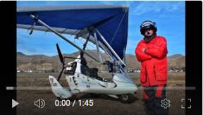
461 YouTube Flying Videos by Jan
Nademlejnsky
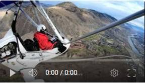
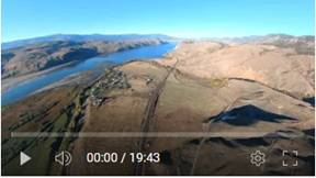
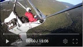
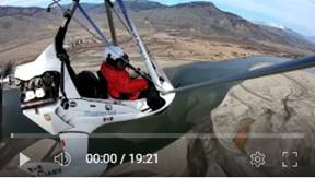
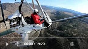
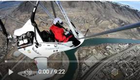
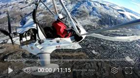
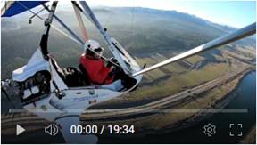 461. South Thompson River Low Water Level. Aerial View from Prichard to Kamloops
Lake, Dec 23, 2023
461. South Thompson River Low Water Level. Aerial View from Prichard to Kamloops
Lake, Dec 23, 2023
I flew 48
km (30 mi) east to Pritchard to start the aerial “survey” view of our main
water supply, South Thompson River. The water
level is really critically low since the summer. It has at least 4 months to go
before “flood season” will develop. It is Christmas and we still did not get
any snow in the lower Kamloops
(airport area). Check the spectacular sand bars at the river delta.
Pictures
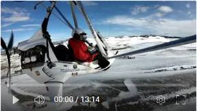
 460. Waiting for Sunset on Cloudy Day. Kamloops
Dec 20, 2023
460. Waiting for Sunset on Cloudy Day. Kamloops
Dec 20, 2023
I wanted to
capture usually very colorful sky at the sunset. Also, I wanted to do it during
the shortest day. Here I was just one day too early because the weather
forecast for the next day was no good for my flying.
I could see
low level clouds all around except very large hole of blue sky over the Brock
and North Shore. As soon as I cleared the low
level clouds I could see high layer of clouds and only a sliver of sun going
down. I stayed up to my legal limit for flying, 30 min past sunset. It was
really very dark, much darker than the video is showing. GoPro cameras
struggled with video stabilization in that dark afternoon and I had to cut that
footage out. It was still very relaxing flight with video to prove it.
Pictures
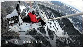
 459. Exploring North Ridge Area
with Beautiful Clouds Formations, Kamloops
Dec 16, 2023
459. Exploring North Ridge Area
with Beautiful Clouds Formations, Kamloops
Dec 16, 2023
Awesome scenery all around
with still no snow by the airport location, while the terrain all around is
snow covered. One of the best flights with 120 km of pure fun.
Pictures
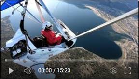
 458. Above Clouds Flight to Sun Peaks and Harper
Mountain, Kamloops Dec 7, 2023
458. Above Clouds Flight to Sun Peaks and Harper
Mountain, Kamloops Dec 7, 2023
An
excellent winter, almost no snow, flight to the second largest ski hill in Canada, Sun Peaks.
I like those conditions with scattered fluffy clouds around me. The visibility
was excellent and just -5 C (23 F). The next waypoint was another, but smaller
ski hill on Harper
Mountain. All that area,
everywhere you look is very diverse and definitely not boring to look at it and
to fly in it. The last leg of my 100 km trip and the most beautiful region in
our area is the South Thompson River valley.
Come in for this video ride and check it out.
Pictures
 457. Very Turbulent Flight to Mt Martin &
over South Thompson River, Kamloops Nov 19, 2023
457. Very Turbulent Flight to Mt Martin &
over South Thompson River, Kamloops Nov 19, 2023
This was
not a relaxing flight, but very challenging and full workout exercise. I was
flying about 100 km (62 mi) in a heavy turbulence with shifting winds in 180
deg direction changes. I wanted to fly to Mt Martin, which is the highest
visible mountain from Kamloops
on east horizon. I had to give it up because the turbulence there was too much
for my taste. The country side is beautiful. I also noticed a lot of smoke far
east in Shuswap Lake valley. It is the nature unfinished
business of 2023 devastating wildfire there.
Pictures
 456. Beautiful, 130 km Scenic
Flight through Campbell Creek Valley and North Ridge Loop, Kamloops Nov 8, 2023
456. Beautiful, 130 km Scenic
Flight through Campbell Creek Valley and North Ridge Loop, Kamloops Nov 8, 2023
This is my best video so far. The weather and
the flying conditions were perfect and the selection of the flight area was
perfect too. Kamloops
area is very spectacular at any time, but it is much more eye pleasing under
good conditions. This was the day.
Brock, N
Shore, downtown, Aberdeen, Knutsford, Shumway Lake, Walker Lake, Campbell
Creek, Barnhartvale, Dallas, Harper Ranch, N Ridge, Sun Rivers, Tranquille
River, Tranquille Farm…
Pictures
 455. Checking 2023 Ross Moore Lake Wildfire Area
Status, Kamloops Oct 29, 2023
455. Checking 2023 Ross Moore Lake Wildfire Area
Status, Kamloops Oct 29, 2023
My
afternoon flight, surprisingly turbulence free to 2023 summer devastating
wildfire with centered by Ross
More Lake.
This 115 km2 (44 mi2) fire had caused a lot of misery to us in this region. I
decided to check if it is really over. I found one smoldering area and 2 still
“lightly” burning spots, which I reported to Canadian Flight Services. I hope
someone is paying attention, because one fire is just 3 km E of Lac Le Jeune
and the other just 8 kn NE from the same lake. I want to have the next summer
smoke free, please!
Pictures
 454. Noon, Fall Colors Flying to Tobiano,
Deadman Valley, Walhachin and Other Areas, Kamloops Oct 22, 2023
454. Noon, Fall Colors Flying to Tobiano,
Deadman Valley, Walhachin and Other Areas, Kamloops Oct 22, 2023
It was 170
km (106 mi) of pure fun. Normally I fly early morning to avoid the usual air
turbulence. The morning rising sun makes the visual conditions very difficult.
The east side of the mountains is almost black and the west side is
overexposed. The cameras cannot handle those extreme contrasts in Auto modes.
This time I
took a chance and flew in the high overhead noon sun. It was perfect in the Deadman River valley which is oriented south to
north. My original plan was to see again the Deadman Falls
at my midpoint. Unfortunately the relaxing conditions abruptly ended in
turbulence 18 km (11 mi) before the Deadman
Falls. I did not want to
take any chances going further north, which is very emergency hostile terrain.
This video
shows very well the Tobiano and Savona,
which I never had opportunity to capture those places that way. It was perfect
time to capture that last days of the beautiful fall colors.
Pictures
 453.
Flying Around Kamloops Lake And More. Kamloops Oct 12, 2023
453.
Flying Around Kamloops Lake And More. Kamloops Oct 12, 2023
It was one of
my best and very relaxing, 130 km long flight. Weather was perfect, a bit on
chilly side, but without those typical and sudden bursts of nastiness. The
nature around Kamloops
Lake is spectacular with
very enjoyable hiking areas there. I turned back over the Deadman
Valley to the lake south side,
crossing Savona
and beautiful Tobiano Golf and residential area. I eventually noticed very low
clouds in the Knutsford area which was fun to fly over. I captured the essence
of the Kamloops City located in extremely beautiful
surroundings. Finally my trip was finished by flying over our sandbars, amazing
and always changing into very original 3D formation under and above the water.
Pictures
 452. Flying to Check Adams Lake Wildfire
Situation. Kamloops Oct 1, 2023
452. Flying to Check Adams Lake Wildfire
Situation. Kamloops Oct 1, 2023
I am
following my failed attempt in previous day to check the Shuswap area affected
by Adams Lake 456 km2 wildfire. This time I made
it there. I was still restricted by required elevation of 2134 m (7000 ft) ASL
to clear the fire zone restriction. You
could see the extent and natural selectivity; one area is burned and the other
is spared. I could saw smoldering areas
E of Squilax Mt (N 50.846390 W 119.54024). I hope someone is still paying
attention to it. As far I know all firefighting aircraft left Kamloops, so ground crew must keep it in
check. I flew 192 km (119 mi) in perfect day but sad situation for fire
affected people.
Pictures
 451. Flying to Shuswap Area. Kamloops Sep 31,
2023
451. Flying to Shuswap Area. Kamloops Sep 31,
2023
This was
the day to fly. Almost sunny and no wind. I decided to check the still active,
but almost over the Adam’s Lake major wildfire
aftermath. I realized on my way east that it might be impossible. NOTAM
restriction specified min elevation 2134 m (7000 ft) ASL (Above Sea Level) in
the fire area of radius of 20 Nm (35 km) from the fire center. I made it to
just 1524 m (5000 ft) and I was already in clouds. I could not legally continue
to clear the restricted zone. I turned around to try the next time. Actually
the next time became the next day with the follow up video.
The flying
day was very interesting with spotty terrain from broken clouds shadows and
changing fall terrain colors. Of course I also checked the ever changing
sandbars in the Thompson River delta by Kamloops Lake.
It was very good day.
Pictures
 450.
Flying over Ross Moore Lake
Wildfire Area, Sep 8, 2023
450.
Flying over Ross Moore Lake
Wildfire Area, Sep 8, 2023
The flying conditions
were very good and even smoke form wildfires was not too bad. I decided to
check the status of Ross Moore Lake
wildfire with its edge just 15 km south of Kamloops city. The 113 km2 (44 mi2) fire was
still classified as out of control, but I did not see any evidence of it. It looked from the air as the fire well in
control. I saw just 3 small areas with still smoldering patches. I called the
location of the first patch (SW of the fire area center) and I was told that
helicopter is flying there every day to check the progress. There should not be
any reason to get it again out of control. The fire was very close to a major
recreation and residential area of Lac
Le Jeune NW of the fire start. I have good aerial view of Kamloops from early morning lit by fresh sun.
I finished my enjoyable flight be several low passes over the river sandbars,
just south of airport. The edges formations were spectacular. Those sandbars are very dynamic, continually
changing by flowing and water level dropping river.
Pictures
 449. Kamloops Area Covered with Wildfire Smoke,
Sep 2, 2023
449. Kamloops Area Covered with Wildfire Smoke,
Sep 2, 2023
It was not an
ideal day to go flying because we had some serious, out of control fires near
by. Also wind direction helped to blow the smoke from the other places
too. I have to turn around in mid
flight, because to visibility was getting critical. I still have very good
video from South Thompson River valley and
from Knutsford area too. I wanted to see the effect of those fires, but it was
impossible from the allowed altitude to see anything. I flew over downtown to
check the rivers water situation and the headed north to Lac Du Bois (lake),
which I visited a day earlier. It is beautiful area and I wanted to see it from
the above too. After flying over Mara Hill and NW Ridge I crossed the river for
low level passes of the ever changing river sandbars. This is always is a
highlight of my flying day.
Pictures
 448. Low Water Level of Thompson Rivers.
Kamloops Aug 19, 2023
448. Low Water Level of Thompson Rivers.
Kamloops Aug 19, 2023
I flew
above both North and South
Thompson Rivers
to check how low the water level is. North Thompson is receiving extra water
from the rains upstream, which is good news. It is very well seen in Kamloops downtown in the
river confluence. The outflow from N Thompson River
is in totally different, grayish silt color. I labeled it in the video as “New
water”. It is not “fresh water” because it is really badly looking. Water level
up MW spilled into dry land and islands flushing all that accumulated stuff
back into the river which we are just receiving here in Kamloops. We are in level 5 drought category
with serious water usage restrictions.
Pictures
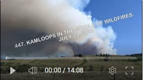 447.
Kamloops in the
Middle of Wildfires. July 23, 2023
447.
Kamloops in the
Middle of Wildfires. July 23, 2023
It was my
interesting, early morning flight.. Flew south by the monster, out of control,
wildfire by Ross Moore Lake.
There is high elevation view of the ever expanding fire, affecting many
evacuated residents. I was surprised to see the fire up to the up wind edge
regardless of very strong wind in the previous day. I expected to see large
burned out area on the up wind, western side, but not. I guess, it is the
unpredictable nature. One half of Kamloops was in serious
smoke cover while the other half, west side was reasonably clear. I also
noticed another, to me just starting fire further north. It looked like some
large camp fire. I reported its location to Kamloops Flight Services. Later
that day I noticed this as already registered Frisken Creek fire. The video
shows the interesting view of Kamloops
city partially shrouded in thick smoke screen…. Overall, it was good 127 km
long flight.
Pictures
 446. Scenic Flight to Chase, Mt Martin, Monte,
Campbell and Scuitto Lakes. July 18, 2023
446. Scenic Flight to Chase, Mt Martin, Monte,
Campbell and Scuitto Lakes. July 18, 2023
Beautiful
and very scenic flight through the Chase-Falkland
Rd valley. The nature colors are changing very
quickly in these unusually hot and dry conditions. There are still some regions
which are very healthily green. I was surprised with unusually, 23 min long
wait for my position to land. I felt
like in an Oshkosh.
Pictures
 445.
Scenic Flight to Little Shuswap Lake.
High Level Views of the River Valley. July 12, 2023
445.
Scenic Flight to Little Shuswap Lake.
High Level Views of the River Valley. July 12, 2023
I was originally
flying to Salmon Arm airport, but heavy smoke from surrounding forest fires
made me to turn back earlier. Regardless, I have very good video of the South Thompson River valley from the higher elevation
then usually. This brought larger areas into my cameras views. It also shows
our vital river quickly losing the water level due to hot and dry weather. It
might be interesting year in Kamloops.
Also visited fire fighting air base to check the water bombers and take some
pictures.
Pictures
 444. Scenic Loop to Highland Valley Copper Mine,
Spences Bridge Area, Ashcroft, Savona… July 4, 2023
444. Scenic Loop to Highland Valley Copper Mine,
Spences Bridge Area, Ashcroft, Savona… July 4, 2023
It was a perfect and scenic flight through very interesting
country sites in various styles. Very nice aerial view of super big, Highland
Valley Copper Mine, open pit operation. I continued then into Nicola River
Valley to check the hwy 8
which was practically destroyed by serious 2022 river flood. There is a 800 ft
long and straight piece to highway which was cut out from the rest of the
highway by the river. This could be potentially used as a landing strip. The
location looks a bit intimidating, but it could be perfect for the mountain
type of pilots. I turned north upstream of Thompson River
to Ashcroft. I skipped the nearby Cache Creek airport, because the turbulence
started already knocking on my back and I wanted to be back ASAP. The Nicola
and Thompson River valleys are spectacular,
but again intimidating for low level style of flying. I crossed Walhachin, Savona, Tobiano and finally Kamloops. I was really moving on my last leg
over the Kamloops
Lake with whitecaps, with
30 km/h (19 mph) tail wind. The tail wind almost instantly changed to headwind
just by the Kamloops
airport. It really woke me up from my peaceful flight. It was rough few
seconds.
Pictures
 443.
Flying to Bonaparte Lake &
Bonaparte Provincial Park via McLure. June 30, 2023
443.
Flying to Bonaparte Lake &
Bonaparte Provincial Park via McLure. June 30, 2023
It was 177
km (110 mi) long flight of pure fun. I tried several times to fly to Bonaparte Lake area, but the bad turbulence always
changed my plans.
I was
really surprised with number of lakes and lash green and beautiful areas. I
also saw ravaged areas from 2021 forest fire, but the nature is slowly
recovering from that disaster. I captured the Kamloops downtown in the early morning sun
and quickly loosing water level in our rivers. We could already see river
sandbars which are normally still under several feet of water.
Pictures
 442. Flying
to Deadman Falls over Tobiano, Savona, Deadman River and Straight Line Back.
June 26, 2023
442. Flying
to Deadman Falls over Tobiano, Savona, Deadman River and Straight Line Back.
June 26, 2023
I visited
the Deadman Falls in 2021 by
motorcycle. I also flew very nearby previously, but at that time I didn’t know
about the waterfalls there. I decided to check it out. It was very good, 153 km
long and very enjoyable flight. The scenery and the nature are spectacular. I
followed the Deadman
River deep valley there
and I flew straight line over totally unknown terrain on the way back. Check it
out; you will like it.
Pictures
 441. Flight
through Nicola Valley to Merritt, Logan Lake and Tunkwa Lake, Kamloops June 17,
2023
441. Flight
through Nicola Valley to Merritt, Logan Lake and Tunkwa Lake, Kamloops June 17,
2023
This was
the day to fly. Absolutely the best conditions to do video. The fluffy clouds
created beautiful spotty patterns on the ground. Everything around was in full
green and healthy looking shape. I flew to small city Merritt airport through
one of the most scenic region Nicola
Valley. It is filled with
many lakes in deep valleys, meadows and rolling hills all in multi shades of
spring green color. After short pit stop I continued above highway 97C to small
village Logan Lake, which almost burned down in
serious forest fire in 2022. I flew over Tunkwa
Provincial Park
and Duffy Lake
back to Kamloops.
It was 180 km (112 mi) of pure pleasure filled with natural beauty. I was back on
the ground at 8:15 am.
Pictures
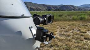 440. Local Flight to Test Gimbal Head GoPro
Camera, Kamloops June 6, 2023
440. Local Flight to Test Gimbal Head GoPro
Camera, Kamloops June 6, 2023
I replaced
my Insta360 X2 camera with GoPro Hero 7B mounted in 3 axes stabilizer Removu
S1. The 360 deg camera is very good, but editing and lining the wanted views is
very tedious and time consuming. I was looking for better results, but I was
disappointed. I was hoping that motorized Gimbal head with 3 gyroscopes would
be proper solution. It is not as shown in the video. I will be going back to
Insta360 X2 as front view camera. You could still enjoy aerial views of Kamloops when all is
green. It looks so good.
Pictures
 439. Extreme Turbulence, Scenic
Flight from Vernon to Kamloops. Part 2 of 2, May 31, 2023
439. Extreme Turbulence, Scenic
Flight from Vernon to Kamloops. Part 2 of 2, May 31, 2023
The return
leg from Vernon to Kamloops was very interesting to say it
mildly. I was mega challenge of extreme conditions in my experience so far:
Terrible turbulence and landing into strong gusty wind, which was not
forecasted.
I chose
more scenic road through the Falkland
Valley. This area is
known for strong and sudden bursts of wind. There is even sign on highway
warning drivers from strong winds. It gave me full work out and tested my
skills, and will to live. It was 20 minutes of swearing and wishing not to be
there. It topped up the landing into totally unpredicted gusty wind of 28-44
km/h (17-27 mph) wind. The original forecast was 6-8 km/h (4-5 mph).
Pictures
 438. Direct
and Peaceful Flight to Vernon, Part 1 of 2. May 31, 2023
438. Direct
and Peaceful Flight to Vernon, Part 1 of 2. May 31, 2023
I was
considering this flight to neighboring airport in Vernon for several years now. It was
definitely out of my comfort zone, not because of distance or terrain, but the
unpredictable flying conditions. The terrain between Kamloops
and Vernon is
combination of mountains, large lakes, many complexly laid valleys and large
open spaces. This creates ripe conditions for multidirectional and gusty winds
and of course turbulence too. The terrain is spectacular, which was the main
attraction for me.
I was up in
the air at 6:15 am to avoid heat changes from cold(er) morning to hot noon,
which brings turbulence. I chose straight line flight over the mountains to Vernon and more scenic route through the Falkland Valley
on the way back. The sun position was also the factor to get better light
condition for my video cameras. Well, the return leg was very interesting to
say it mildly. I was mega challenge of extreme conditions in my experience so
far: Terrible turbulence and landing into strong gusty wind, which was not
forecasted.
Pictures
 437. Flight to Barriere,
Whitecroft, Barnhartvale, 180 km of Beauty. May 26, 2023
437. Flight to Barriere,
Whitecroft, Barnhartvale, 180 km of Beauty. May 26, 2023
This was
another beautiful flight through less traveled areas. I followed the North Thompson River up to McLure ferry and then over the
mountains to Barriere. The next leg led me to Whitecroft, small village near Sun Peaks.
I followed the narrow valley filled with all kind of green colors. The nature is fully transformed now from the
dark winter colors to bright greens. The third leg of my 180 km long flight was
to Buse Lake area in Barnhartvale area. The Buse Lake
is completing its summer transformation into purple/red color.
I tried many times for several years
to fly close to the Rock Needle of Buse Hill, but the weather conditions had
always different plans. It looked promising this time, but my main, full view
camera battery died. I flew close, but still encounter unpleasant turbulence
there. I completed my journey above the south side of the South
Thompson River and recording views of Barnhartvale, Juniper Ridge
and Kamloops Sahali area. Other areas to
see are Brocklehurst,
Batchelor Heights,
Westsyde, Ida Lane
hill, North Thompson River valley residential
areas.
Pictures
 436. Flight
to Sun Peaks, Chase and High Water Level of South Thompson River. May 19, 2023
436. Flight
to Sun Peaks, Chase and High Water Level of South Thompson River. May 19, 2023
Beautiful
flight to quickly changing Sun Peaks from winter ski paradise to green mountain
playground. I continued to small village Chase, which is start of South Thompson River. I flew over the river which is
spilling over in some areas; annual cycle from very low at over high water
levels.
It is
interesting to compare the river valley character between those two extremes.
See my video # 432 from Apr 14, 2023
for comparison.
Pictures
 435. Return Flight from Cache
Creek to Kamloops, May 11 2023
435. Return Flight from Cache
Creek to Kamloops, May 11 2023
This is the
second part (video #434) of my trip
to Cache Creek to see the flooding situation there. The flight is threading through
very interesting geographical nature with beauty in every direction.
Pictures
 434. Flight to Cache Creek to Check the River
Flooding Situation. Kamloops, May 11 2023
434. Flight to Cache Creek to Check the River
Flooding Situation. Kamloops, May 11 2023
It was an
interesting flight in the Thompson and Bonaparte river valleys to see the
flooding river conditions. Small town of Cache Creek was already affected by
damaging flood and expecting additional flood by Bonaparte River.
I flew over Ashcroft and Cache Creek from south to north. I landed at local and
to me intimidating and challenging airport with unpredictable weather and
thermal conditions. I had to land to change battery of my video camera. Whole
area changed already from dry brown and brownish color to increasingly green
colors from nature fast spring awakening.
Pictures
 433. Following
Tranquille Canyon to Fire Devastated Red & Sparks Lakes Areas, Deadman
Valley, Walhachin, Tobiano… Apr 27, 2023
433. Following
Tranquille Canyon to Fire Devastated Red & Sparks Lakes Areas, Deadman
Valley, Walhachin, Tobiano… Apr 27, 2023
I was
considering this flight for several years now, but the terrain looks and is
very intimidating. The gold containing Tranquille Creek is running in very deep,
steep and narrow canyon. Definitively any mechanical or even environmental
failure would be total disaster in that hostile environment. I started early in
the morning to limit my exposure to expected turbulence, but it was still not
relaxing flight. The strong headwind created mechanical turbulence behind and
around the hills. This combined with warm and cold sides of the canyon created
very good turbulence. Well, I made it through! It is very nice in the Red Lake
area, which follows the Sparks
Lake. The Sparks Lake
became “famous” in June 2021 when someone set forest on fire. It was hell on
earth: 52 buildings, over 90,000 ha of forest gone, and millions spent on
aerial and ground fire fighting. It was terrible summer even for us living 40
km away from it.
The sky was
very clear and visibility perfect so you could see the Costal Mountain Ridge
still covered in snow. Covered also Deadman
Valley, Walhachin area, Savona, Pat Lake, Tobiano, Cherry Creek, South
Thompson River sand bars, Tranquille Farm.
Pictures
 432.
Complete South Thompson River, Low Water Level Aerial Survey, Kamloops, Apr 14, 2023
432.
Complete South Thompson River, Low Water Level Aerial Survey, Kamloops, Apr 14, 2023
Here is my
aerial survey of all South Thompson River from Chase to Kamloops delta. I wanted to capture the 2023
lowest water level in that river.
It was very
nice and interesting flight. I received warning form the Kamloops Flight
Services about ash from Russian (Kamchatka)
volcano 4,800 km away. Eventually I had an experience with that strange
phenomena. I saw two big snow falling areas in my path which could be dangerous
with very strong winds. That cold air is usually sucked into my sun heated
warmer air where I was. I experienced it already once and I don’t care for any
repetition. I noticed when editing my videos that the snow area was actually
very local ash fall. I noticed it on my camera and my windshield was very
dusty. The sky was very diverse and interesting. Unpleasant flight against
early morning rising sun with poor visibility turned out to be fun flight from
Chase to Kamloops.
https://youtu.be/Y4S70MYuQKM
Pictures
 431. Kamloops from the Air in Heavy Turbulence,
Apr 11, 2023
431. Kamloops from the Air in Heavy Turbulence,
Apr 11, 2023
I wanted to
document extremely low water level in whole South Thompson
River. I did the second half of it in my video 429 from March 20, 2023.
I did not
make it too far this time, because of very strong and unpleasant turbulence. I was getting air sick and I did not want to
push my luck. I had to give up. I hope I could make it soon. I brought very
interesting video from around the Kamloops
city.
Pictures
 430.
Flight to Lac Le Jeune and Detail Survey
of Kamloops Sandbars, Kamloops Mar 29, 2023
430.
Flight to Lac Le Jeune and Detail Survey
of Kamloops Sandbars, Kamloops Mar 29, 2023
I flew over
scenic road to Lac Le Jeune Provincial Park, campground and residential area.
While Kamloops
valley is practically snow free and in spring like weather, the area south is
still in full winter mode. I turned SE to Knutsford area, over Paterson Creek
canyon to Kamloops
downtown. I then followed South Thompson River to its delta to Kamloops Lake. I made over 50 km above those
spectacular sand bars. The river water level is in its seasonal lowest point so
the sand beaches and the sandbars areas are enormous. They will disappear under
water in June to August with not unusual flood in lower city elevations. I
documented special twist to crop circles. By the SW of river delta. If you have
chance to watch this video on TV then you will not regret it. You will not see
it again as it is, because they are always changing and slowly disappearing
with the spring runoff.
Pictures
 429.
Checking Low Water Level of North and
South Thompson Rivers, Kamloops
Mar 20, 2023
429.
Checking Low Water Level of North and
South Thompson Rivers, Kamloops
Mar 20, 2023
Kamloops probably reached to lowest river
level this season. It is really low. Spring and spring temperatures are here
which started snow melting from the mountain and high elevation regions. I
wanted to capture this event which is only possible to se from the air and
preferably from low elevation. I flew east 43 km (27 mi), past the Monte Creek
above of the South Thompson River. I also used
a clip insert from June 24, 2012 when rivers water level was just peaking out
for comparison. After that, I turner NW towards McLure by North
Thompson River. I changed my direction due to turbulence. I flew
instead over Pinantan and Paul Lakes and over the Lyons
Lake to the “end of civilization” of North Thompson River. I followed the rivers to airport
which was 72 km (45 mi) away.
Pictures
.
 428. Flying
to Buse Lake in no Fun Turbulence. Mar 16, 2023
428. Flying
to Buse Lake in no Fun Turbulence. Mar 16, 2023
I have been
trying 11 years to do close up of Buse Hill rock face needle, but the flying
conditions had been too dangerous to do it. The turbulence was too much for my
fun even far away from the hill. I toured above several Kamloops
subdivisions, like Valleyview, Dallas,
NE river shore cliffs, Sun
Rivers, Batchelor Hills, North Ridge… I am also showing detail views of
spectacular nature creation, sand bars of South Thompson
River delta. It is my favorite area to fly, because it is always
different. This is the only way to see it and also to see what is under water
too.
Pictures
 427. Flying
to Harper Ranch, Campbell Creek Rd to Knutsford, Ajax, Afton, Cherry Creek,
Kamloops, Mar 9, 2023
427. Flying
to Harper Ranch, Campbell Creek Rd to Knutsford, Ajax, Afton, Cherry Creek,
Kamloops, Mar 9, 2023
I ventured
a bit behind the hills in area which might not be very well known. All this is
presented with easy listening music. You could see: Brock, North Shore,
Sun Rivers,
North Ridge with Mt Peter & Paul, Harper Ranch Dallas, Barnhartvale,
Campbell Creek, Shumway Lake valley, Knutsford, Ajax
mine, Jacko Lake,
Afton mine, Cherry Creek area, South Thompson River
sand bars.
Pictures
 426. Flying to Harper Ski Hill in very Good
Turbulence. Kamloops Mar 3, 2023
426. Flying to Harper Ski Hill in very Good
Turbulence. Kamloops Mar 3, 2023
Beautiful,
but turbulent flight to Kamloops
area 2nd largest ski hill.
Pictures
 425. Flying
over the City. Short, Intro Video. Kamloops Feb 11, 2023
425. Flying
over the City. Short, Intro Video. Kamloops Feb 11, 2023
Pictures
 424. Flying
over East of City, Valleyview, Dallas, Barnhartvale and then Sun Rivers, North
Shore and Brock. Kamloops Feb 11, 2023
424. Flying
over East of City, Valleyview, Dallas, Barnhartvale and then Sun Rivers, North
Shore and Brock. Kamloops Feb 11, 2023
This is the second part of my detailed city fly over.
Pictures
 423. Flying
in Survey Pattern over South Side of City, Kamloops Feb 15, 2023
423. Flying
in Survey Pattern over South Side of City, Kamloops Feb 15, 2023
It decided to do detail fly over the south side of Kamloops city in a survey
type of track pattern. This covers the largest and the hilliest part of Kamloops. It shows our
diverse and very complex terrain which must really challenge for the city
planners and maintainers. The video is result of 93 km over that city section.
Pictures
 422. Flying
to Beautiful Area of Walhachin. Kamloops, Feb 9, 2023
422. Flying
to Beautiful Area of Walhachin. Kamloops, Feb 9, 2023
It was beautiful winter day to have some good fun in the air.
Sunny sky and temperature above freezing added to that special mood. The
Walhachin area has very interestingly carved winding river banks, looking like
being made by a machine. The flight to that place goes through many natural
wonders looking spectacular from the ground and the air. Places to see from 113
km long flight: North Shore, Domtar, river junction, Aberdeen, Dufferin, Afton
mine, Cherry Creek area, Tobiano, hoodoos, Balancing Rock, Savona, Thompson
River rec areas, Walhachin, South Thompson River delta sand bars…
Pictures
 421. Flying
with the Clouds. Kamloops, Jan 15, 2023
421. Flying
with the Clouds. Kamloops, Jan 15, 2023
This video
has background music
Another
interesting flying conditions: Heavy, multi-layer clouds, blue sky, bright
sunshine, dark ground areas. I covered North Ridge, Batchelor area, North Thompson River, Westsyde, Mt Mara, Tranquille Creek
valley, Lac du Bois Area. The Tranquille-Criss Creek, normally deep and steep
valley was under clouds. This created very interesting visual effect. See also
nice Sundog (Halo) effect in the clouds
I had
interesting moment before my landing when looking for entry hole in the clouds.
I had to ask the control tower to check it for me, which they did. It was
difficult to see anything except very bright white fluffs reflecting the sun
directly into my face. Another moment happened while I was taking pictures
above Batchelor subdivision where I was hit with sudden and strong updraft,
which almost ripped the control bar from my hand. It was fun and interesting
flight.
Pictures
 420. Flying with the Clouds.
Kamloops, Jan 15, 2023
420. Flying with the Clouds.
Kamloops, Jan 15, 2023
This
video has no background music.
Another
interesting flying conditions: Heavy, multi-layer clouds, blue sky, bright
sunshine, dark ground areas. I covered North Ridge, Batchelor area, North Thompson River, Westsyde, Mt Mara, Tranquille Creek
valley, Lac du Bois Area. The Tranquille-Criss Creek, normally deep and steep
valley was under clouds. This created very interesting visual effect. See also
nice Sundog (Halo) effect in the clouds
I had
interesting moment before my landing when looking for entry hole in the clouds.
I had to ask the control tower to check it for me, which they did. It was
difficult to see anything except very bright white fluffs reflecting the sun
directly into my face. Another moment happened while I was taking pictures
above Batchelor subdivision where I was hit with sudden and strong updraft,
which almost ripped the control bar from my hand. It was fun and interesting
flight.
Pictures
Flying Videos in 2022